Objective
The objective of this study is to assess the temporal changes in urban service facilities of a zone of Khulna City (2011–2021) and evaluate urban problems and land use transformation.
Methodology
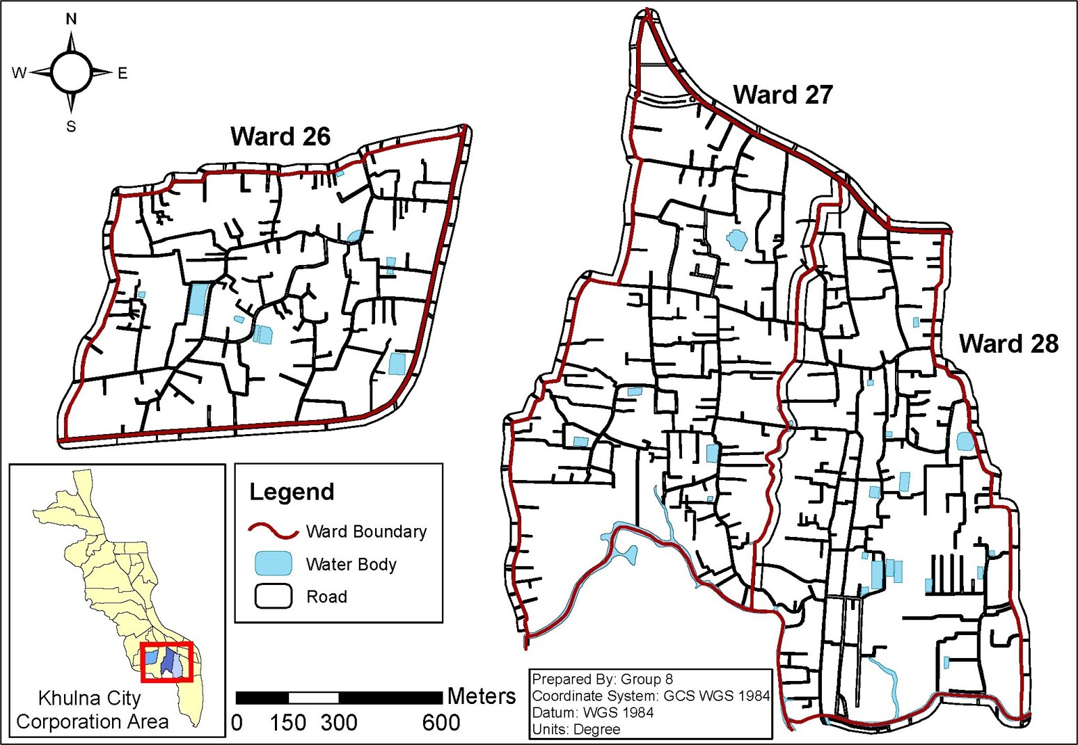
- Study Area: Ward 26, 27 and 28 of Khulna City Corporation have been selected as study area for this study. These wards fall under the detailed area development plan (DADP) zone 20 named Tutpara. These wards have been chosen because of these are one of the densely developed and waterlogging-prone areas in Khulna.
- Primary Data: Field survey, stakeholder consultation, and Participatory Urban Appraisal (PUA).
- Secondary Data: Several types of data were collection such as, DEM of Khulna from NASA Earth Data, Landsat Satellite imagery from USGS, shapefiles of Khulna administrative areas and demographic data from Banlgadesh Bureau of Statistics.
- Methods: Relative Importance Index (RII) analsis for ranking of urban problems, DEM-based drainage analysis and temporal changes of landuse through LULC classification of 2011 and 2021
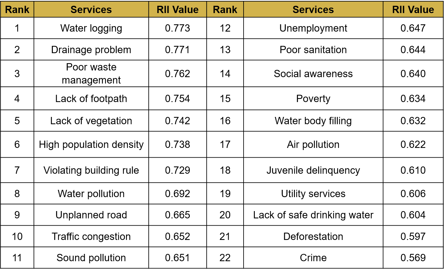
Key Findings (RII)
- The RII analysis identifies water logging (0.773), drainage problem (0.771), and poor waste management (0.762) as the most critical issues, clearly dominating the study area’s challenges.
- Infrastructure and environmental stress remain prominent, with lack of footpath (0.754), vegetation loss (0.742), and water pollution (0.692) indicating pressure on basic urban systems.
- Socio-economic issues such as unemployment (0.647) and poor sanitation (0.644) exist but are less critical compared to physical and service-related problems.
- The least critical concerns are crime (0.569), deforestation (0.597), and lack of safe drinking water (0.604), suggesting relatively better conditions in these aspects.
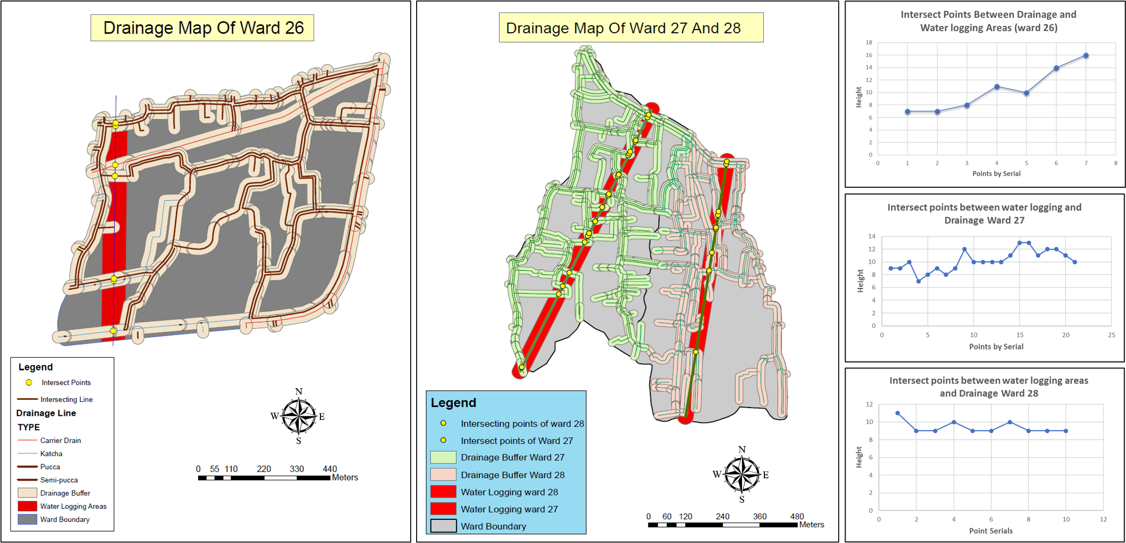
Key Findings (Drainage and Waterlogging)
- Waterlogging zones were identified through drain–intersection analysis, showing concentration of problem areas along connected drainage lines.
- Ward 27 was the most critical, with 21 drain intersections within waterlogged zones, compared to 10 in Ward 28 and only 7 in Ward 26, indicating severe drainage stress.
- The high number of intersecting points suggested blocked, undersized, or poorly connected drains, especially in Ward 27.
- Elevation profiles showed irregular slope patterns (around 7–16 m variation), confirming inadequate gradient for proper water discharge.
- Overall, the area suffered from flat terrain, insufficient drainage capacity, and poor maintenance, leading to localized flooding problems.
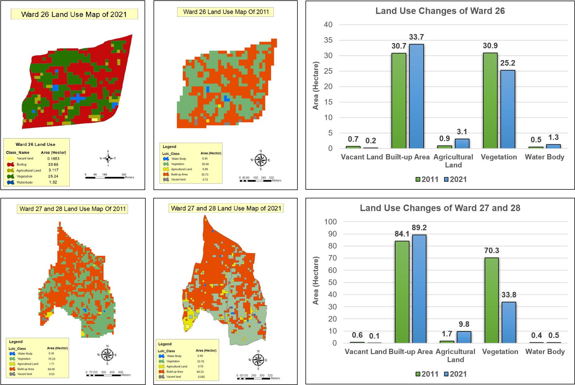
Key Findings (Temporal Changes of Landuse)
- LULC analysis shows a clear shift toward built-up expansion across all wards, replacing vegetation and vacant land over the 10-year period.
- Ward 26 experienced moderate urban growth, with built-up area increasing from 30.7 ha to 33.7 ha, while vegetation declined from 30.9 ha to 25.2 ha, indicating steady land conversion.
- Wards 27 and 28 show more intense transformation, where built-up area rose from 84.1 ha to 89.2 ha, alongside a sharp drop in vegetation from 70.3 ha to 33.8 ha, reflecting aggressive land use change.
- Overall, the trend reflects unplanned densification and loss of green cover, contributing to drainage inefficiency and rising environmental stress.